Thursday, September 21, 2006

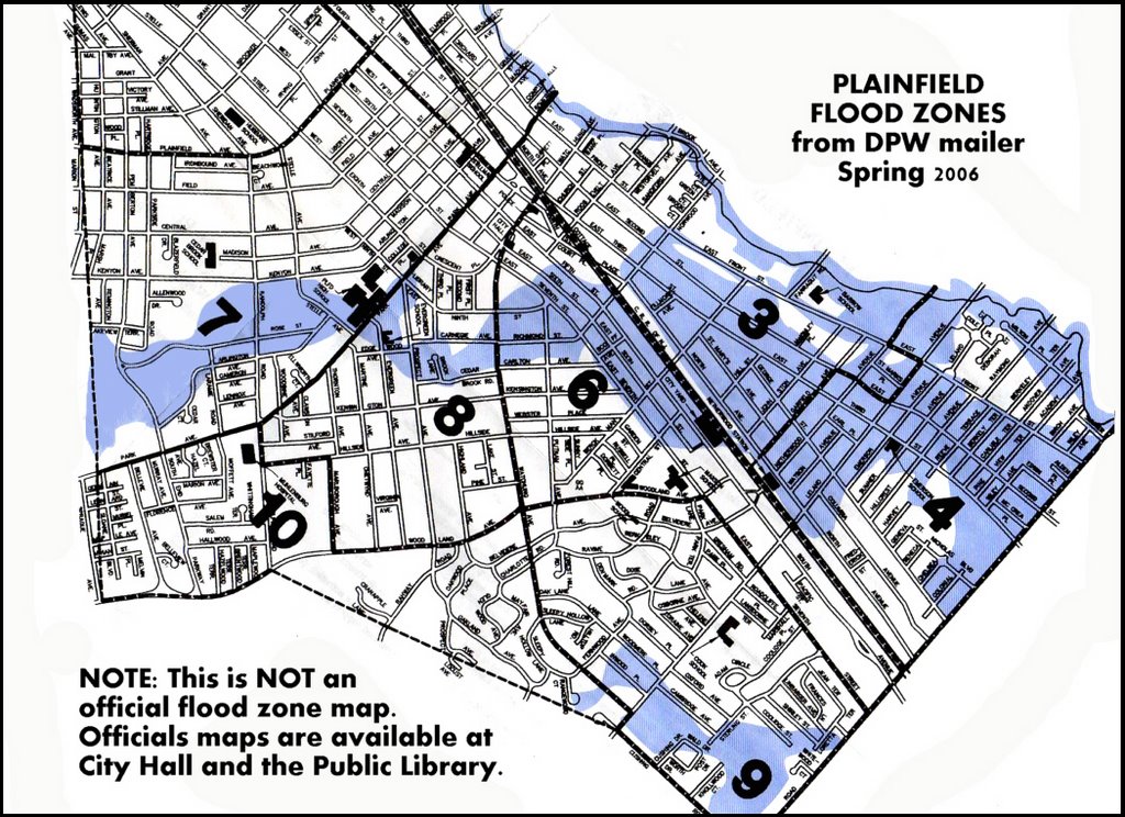
Flood Zones - Map at 100 dpi - 2006

*


The map above is scanned at 100 dpi from the Spring 2006 mailer of the Plainfield Division of Public Works. Blue flood zones are only a general indication.

OFFICIAL flood maps may be viewed at City Hall or the Plainfield Public Library.


-- Dan Damon

Blog Archive

About Me

Plainfield resident since 1983. Retired as the city's Public Information Officer in 2006; prior to that Community Programs Coordinator for the Plainfield Public Library. Founding member and past president of: Faith, Bricks & Mortar; Residents Supporting Victorian Plainfield; and PCO (the outreach nonprofit of Grace Episcopal Church). Supporter of the Library, Symphony and Historic Society as well as other community groups, and active in Democratic politics.